Transport
Bangkok's Rail Network Map, Explained
How Bangkok's BTS, MRT, Airport Rail Link and SRT systems fit together, what the colours and station codes mean, and how to plan a route across all of them.
On this page
Bangkok’s rail map looks like one integrated system. It is not. It is at least four separate operators whose lines happen to cross at a handful of stations, each running its own ticketing, its own fare structure and, in places, its own idea of what counts as a transfer. Once you know who runs what and how the colour-and-code scheme works, the map stops being confusing and starts being useful.
Four operators, not one network
The BTS Skytrain (Sukhumvit and Silom lines) is run by the Bangkok Mass Transit System company under a concession from the Bangkok Metropolitan Administration. The MRT (Blue, Purple, Yellow and Pink lines) is operated by the Bangkok Expressway and Metro company (BEM) under contract to the Mass Rapid Transit Authority of Thailand (MRTA), the state body that owns the infrastructure. The Airport Rail Link runs under the State Railway of Thailand (SRT), as do the SRT Dark Red and Light Red suburban lines that now share Krung Thep Aphiwat Central Terminal as their hub. A short, separate Gold Line monorail on the Thon Buri side of the river is run by BTS’s operating arm but sits outside the main Sukhumvit-Silom network.
None of this is visible on a glance at a transit map, where every line is just a coloured stripe. It matters because it decides your ticket. A BTS single-journey ticket is worthless on the MRT and vice versa; the Airport Rail Link sells its own tokens; the SRT Red Lines use their own fare gates. Stored-value cards exist for each system (Rabbit for BTS, the MRT card for the metro), and while a unified “one card for everything” has been discussed for years, in practice you are still topping up separate balances or buying separate single tickets depending which system you are on. Checking current fares and card compatibility on each operator’s own site or app before a long trip is worth the two minutes it takes.
Reading the colours and codes
Every line has a colour, and most stations carry a short alphanumeric code that tells you the line and the station’s position along it. The scheme is genuinely useful once you know the pattern:
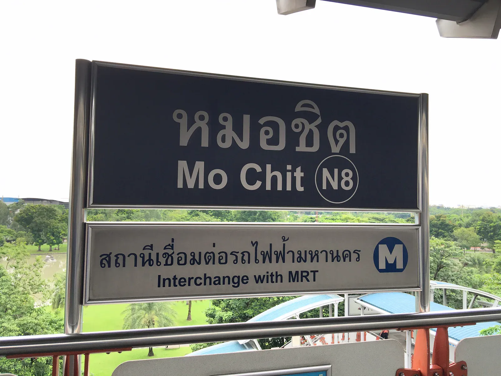
- BTS Sukhumvit Line (light green): the northern half uses codes N1-N24 running from Siam out towards Khu Khot; the eastern half uses E1-E23 running from Siam out towards Kheha. Siam itself is the pivot and carries the code CEN.
- BTS Silom Line (dark green, sometimes shown as a darker stripe next to the lighter Sukhumvit line): codes run S1-S12 from Siam towards Bang Wa, with a short western extension using W1 at Bang Wa itself.
- MRT Blue Line: codes BL1 upward, running as a loop-shaped route through the city centre, Chinatown and Thon Buri.
- MRT Purple Line: codes PP1 upward, running from Tao Poon out to Nonthaburi’s outer suburbs.
- MRT Yellow Line (monorail): codes YL1 upward, linking Lat Phrao to Samrong.
- MRT Pink Line (monorail): codes PK01 upward, linking Nonthaburi to Min Buri.
- Airport Rail Link: codes prefixed A, running from Phaya Thai to Suvarnabhumi Airport.
- SRT Dark Red Line: runs north from Krung Thep Aphiwat Central Terminal towards Rangsit; SRT Light Red Line: runs west towards Taling Chan.
The number tells you roughly how far a station sits from the line’s reference point, which is handy for judging distance at a glance: a low number is close to the centre, a high number is out towards the suburbs. It is not a substitute for checking the map, but it means you can tell that N9 is further from town than N3 without counting stops.
The shape of the network: a dense core, long arms
Bangkok’s rail map has a distinctive shape once you stop thinking of it as a grid. There is a dense, overlapping core roughly bounded by Siam, Silom, Sukhumvit and the river, where several lines run close together and interchanges cluster. From that core, individual lines stretch out as long single arms towards the suburbs: Sukhumvit east towards Samut Prakan, Sukhumvit north towards Pathum Thani, the Blue Line loop out to Bang Khae and Lak Song, the Purple Line out towards Bang Yai. There is very little redundancy on those outer arms: miss the line and there is usually no parallel rail alternative, only the road. To place the rail lines against the river and old town, see our Bangkok map and neighbourhood guide.
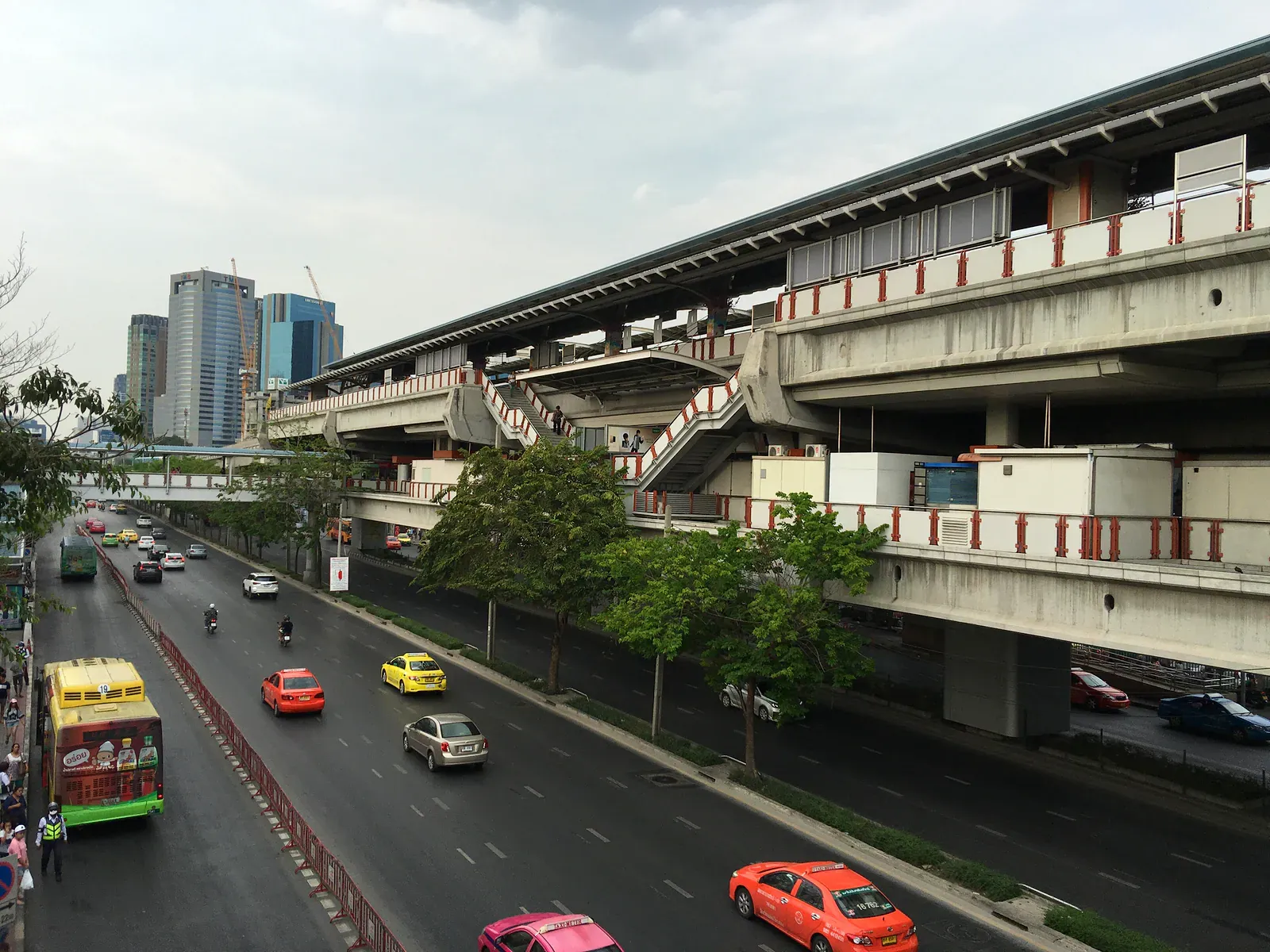
This matters for planning. A trip that stays inside the core can often be done two or three different ways, mixing lines at will. A trip to an outer suburb usually has exactly one sensible rail route, and getting off that line stranded is a road journey, not a rail one.
The lines that matter to a visitor
For a short stay, three lines do almost all the work: the BTS Sukhumvit Line through the hotel and shopping belt (Siam, Chit Lom, Asok, Phrom Phong, Thong Lo), the BTS Silom Line for Silom, Sala Daeng and the Chong Nonsi business district, and the MRT Blue Line for the old city, Chinatown and the river crossing near Hua Lamphong. The Airport Rail Link matters once, for the airport transfer itself, and connects at Phaya Thai to the Sukhumvit Line. Add the river boats (see the guide to the Chao Phraya piers) and a first-time visitor rarely needs anything beyond those four pieces.
The lines built for commuters
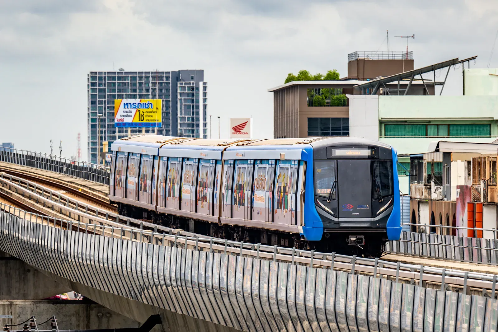
The Purple Line, the Yellow Line, the Pink Line and the SRT Red Lines exist mainly to move residents of Nonthaburi, Pathum Thani and the eastern and northern suburbs into the core, and they show it: longer gaps between trains off-peak, stations designed around park-and-ride rather than street life, and connections that assume a bus or motorbike taxi for the last stretch. None of that makes them useless to a visitor (the Yellow Line, for instance, is a reasonable way to reach parts of On Nut and Srinakarin that the Sukhumvit Line doesn’t touch directly), but they reward someone who already knows their destination, not someone browsing.
Lines at a glance
| Line | Colour | Operator | What it actually serves |
|---|---|---|---|
| BTS Sukhumvit | Light green | BTS (BMA concession) | Siam, Sukhumvit corridor, Mo Chit, Chatuchak, Samut Prakan suburbs |
| BTS Silom | Dark green | BTS (BMA concession) | Silom, Sala Daeng, Chong Nonsi, Thon Buri via Bang Wa |
| MRT Blue | Blue | BEM (MRTA contract) | Old city, Chinatown, Hua Lamphong area, Lat Phrao, Thon Buri loop |
| MRT Purple | Purple | BEM (MRTA contract) | Nonthaburi suburbs, Tao Poon interchange |
| MRT Yellow | Yellow (monorail) | BEM (MRTA contract) | Lat Phrao to Samrong, cross-town suburban link |
| MRT Pink | Pink (monorail) | BEM (MRTA contract) | Nonthaburi to Min Buri, northern and eastern suburbs |
| Airport Rail Link | Dark red/maroon | SRT | Phaya Thai to Suvarnabhumi Airport |
| SRT Dark Red | Red | SRT | Krung Thep Aphiwat Central Terminal to Rangsit |
| SRT Light Red | Pink-red | SRT | Krung Thep Aphiwat Central Terminal to Taling Chan |
| Gold Line | Gold (monorail) | BTS operating arm | Short Thon Buri shuttle near ICONSIAM |
Extensions and what “opening soon” means
Bangkok’s rail map has been under construction for two decades and remains a moving target. Several lines that appear on current maps as dotted or greyed-out extensions are years from carrying passengers; the planned Orange Line, for example, has had its target opening pushed back more than once and, at the time of writing, is still under construction rather than running. Treat any “opening [year]” claim on a map or in an app as provisional and check the operator’s own announcements close to your trip if a specific extension matters to your plans. The practical rule: only plan around lines that are already open. Extensions are a bonus if they land on schedule, not something to build an itinerary on.
When two systems don’t share a ticket
The single biggest source of wasted time for newcomers is assuming that because two stations look connected on a map, moving between them is a simple walk-through transfer. Often it is, but only within the same operator. Move between BTS and MRT, or between either and the Airport Rail Link, and you will normally exit through a fare gate, walk a corridor or a stretch of street, and buy a fresh ticket on the other side. That is a design fact of Bangkok’s transit, not a flaw in any one station, and it is the entire subject of the guide to interchange stations, which covers what to expect at each major transfer point and how long to allow.
Planning a route across systems
A few habits make cross-system journeys painless rather than stressful:
- Identify the operator boundary before you set off. If your trip crosses from a BTS-coded station to an MRT-coded one, budget time and a second fare for the transfer.
- Use a journey planner that shows all operators, not just one company’s own app, which will naturally favour its own lines.
- Keep small change or a topped-up card for each system you expect to use: running out of balance mid-transfer is the most common hold-up at gate lines.
- On the outer arms, check the last-train time for your specific line, since suburban lines can run a noticeably earlier last service than the core network.
- Where a river crossing is faster than a rail transfer, it usually is: see the piers guide for when the boat beats the train.
When the network doesn’t behave: closures, crowding and the last train
The rail network is reliable most of the time, but four situations catch out people who’ve only ever known it running normally, and each has a different practical response.
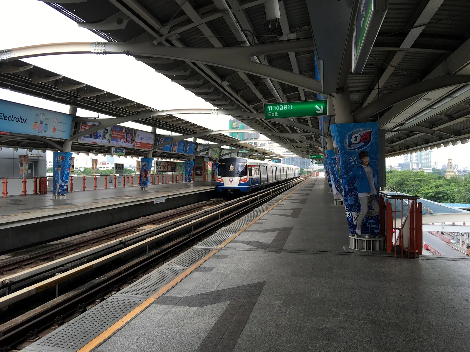
Planned closures. Operators occasionally close a station or a short section overnight or on specific dates for maintenance, engineering work or an upgrade, usually announced in advance on the operator’s own app, site or station signage rather than through general news. If a specific trip matters (an early flight, an appointment you can’t be late for), checking the relevant operator’s own channel the day before is worth the two minutes, since a closure that doesn’t affect most daily commuters can still derail a one-off trip that happens to fall on that date.
Unplanned disruption. Signal faults, a medical incident on a train, or an operational problem can stop a line or slow it substantially with little warning. Stations generally post updates on platform screens and via staff, but the practical response is the same regardless of cause: check whether a parallel line or the river boats (see the Chao Phraya piers guide) cover a similar route before committing to wait it out, since a stalled line in the dense core often has an alternative, while a stalled line on one of the long outer arms usually doesn’t: see the shape-of-the-network point above for why.
Crowding control at busy interchanges. During peak commuting hours, and during major events near a central station, staff at some interchanges (Siam and other core-network hubs in particular) manage platform crowding by temporarily restricting entry to the platform level, holding passengers in the concourse until space clears. This is a safety measure, not a malfunction, and it can add several minutes to a journey through an affected station during the busiest window. Building a small buffer into a peak-hour trip through a major interchange is a reasonable habit, not overcaution.
The last train, and why it matters more on the outer arms. Last-train times vary by line and can be earlier than visitors expect, particularly on the suburban Purple, Yellow, Pink and SRT Red lines, which as noted above tend to run a thinner off-peak and evening schedule than the core BTS and Blue Line network. Missing the last train on one of the long outer arms generally means a road journey the rest of the way, since there is little to no parallel rail alternative out there. Checking the specific last-train time for your actual line (not a general assumption based on the core network’s hours) before a late night out is the single most useful habit this section can offer.
What to actually do when a line stops under you. Get off at the next open station rather than staying on an idle train, check the platform screens or the operator’s app for whether service is expected to resume soon or is suspended for the rest of the service day, and default to a road option (taxi, ride-hailing, bus) for anything time-sensitive rather than waiting indefinitely on an unclear update. The cost of a short ride-hailing trip is a small price for certainty compared with an open-ended wait for a system that may not say clearly when it’s expected back.
Common questions
Is there one ticket that works on every Bangkok rail line?
No single ticket currently covers BTS, MRT, the Airport Rail Link and the SRT Red Lines together. Each system sells its own single tickets and its own stored-value card, and you top up or buy fresh for each one you use. Check each operator’s site or app for current card options before a trip that mixes several systems.
What do the letters and numbers in a station code mean?
The letter identifies the line or line segment (N and E for the two halves of the BTS Sukhumvit Line either side of Siam, S and W for the Silom Line, BL for the MRT Blue Line, and so on), and the number marks the station’s position along that segment, counting outward from the reference point. A higher number is generally further from the centre.
Which lines are actually useful for a short visit?
The BTS Sukhumvit and Silom lines and the MRT Blue Line cover almost everywhere a first-time visitor goes: the main shopping and hotel districts, Silom, and the old city and Chinatown. The Airport Rail Link matters for the one trip to or from Suvarnabhumi. Everything else is more useful to residents of the suburbs it serves.
Why do some interchanges require leaving the station and re-entering?
Because the two lines meeting there belong to different operators with separate fare systems and separate paid areas. Only transfers within the same operator’s network (mainly between the BTS Sukhumvit and Silom lines at Siam) stay inside one continuous paid zone.
Is the MRT Orange Line open yet?
Not as a complete route at the time of writing; construction has continued for years with the opening date revised more than once. Do not build a specific trip around it without checking current status close to travel.
Does the network reach both airports?
The Airport Rail Link connects central Bangkok to Suvarnabhumi Airport. Donmueang Airport is not on the core rail network in the same direct way; reaching it typically means a connection via the SRT Dark Red Line or another surface mode, so it is worth checking your specific route in advance rather than assuming a single-line ride.
Written by
Mike Brochlowski
Founder and editor, travel photographer and designer
I'm Mike Brochlowski, a travel photographer and designer, and I currently live on Koh Samui, Thailand. I built BangkokWiki to put practical, checked information about Bangkok in one place. Every page is researched from official and primary sources, and the text names them. Where a page shows a checked date, that is when its facts were last confirmed. I also run samui69.com, a non-commercial guide to Koh Samui. If you spot an error or something out of date, tell me through the contact page and I will check it and correct the page.
Read all articles
Where to stay
Pick the area before the hotel
Traffic and heat make Bangkok distances feel longer than they look on a map, so the area shapes a trip more than the hotel does. Our guides match areas to trip types and explain the trade-offs.

Places to stay
Find a hotel
Explore the other desks
More from Transport
- 10 min read
 10 min read
Chao Phraya Express Boat Piers: A Practical Guide
 9 min read
KL Bangkok Flight, Plus Manila, Saigon and Jakarta

Newsletter
You're subscribed as